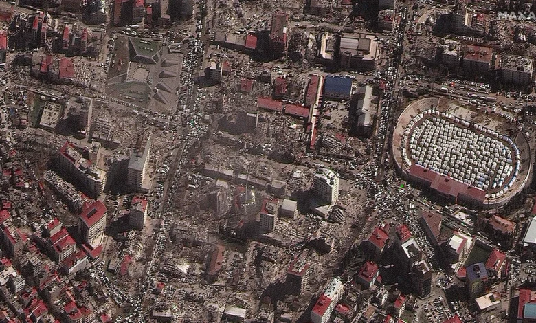
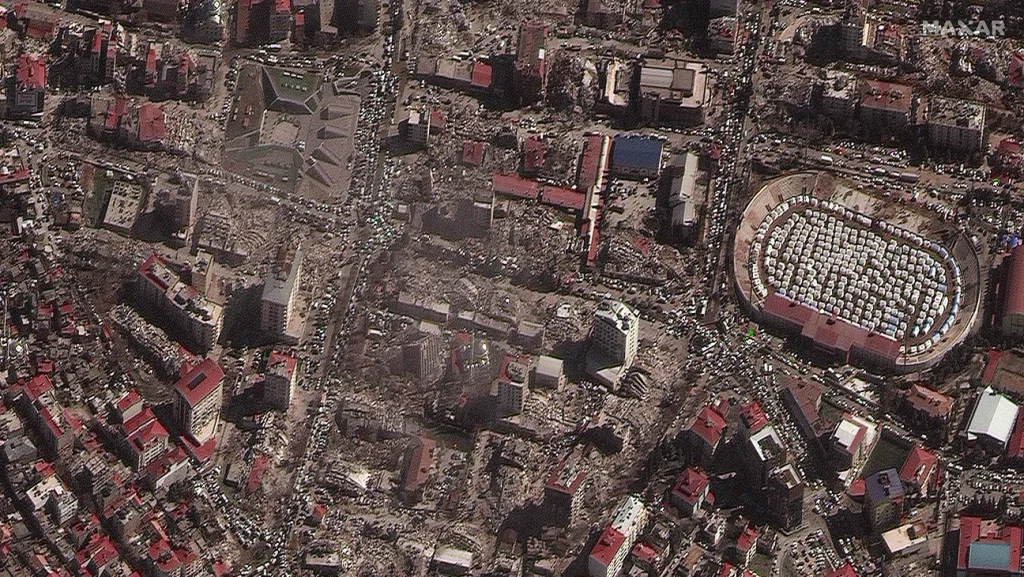
After the earthquake, there is nothing left in the area. A shelter camp has been opened in the stadium. 8 February 2023 Photo: AFP
Satellite images before and after the earthquake
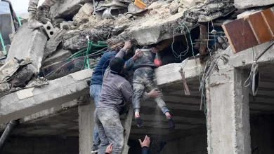
The extent of the damage caused by the powerful earthquake in Turkey can be seen in satellite images. The cities which were organized a few days ago, have now turned into ruins. Somewhere the buildings are mixed with the ground. The residents of these buildings have now taken up residence in temporary shelters built in various open spaces including the stadium.
Satellite images before and after the earthquake
1 / 6
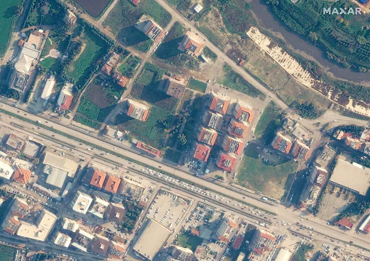
An area in the Turkish city of Antakya before the earthquake. 22 December 2022 Photo: Reuters
2/ 6
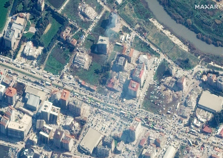
After the earthquake, the area was devastated. Smoke can be seen coming from some buildings. 8 February 2023 Photo: Reuters
3/ 6
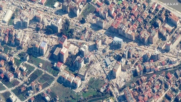
In the city of Antakya a few days ago, the buildings stood in the green. 22 December 2022 Photo: Reuters
4/ 6
Many buildings in that area have been mixed with the ground. 8 February 2023 Photo: Reuters
5/ 6
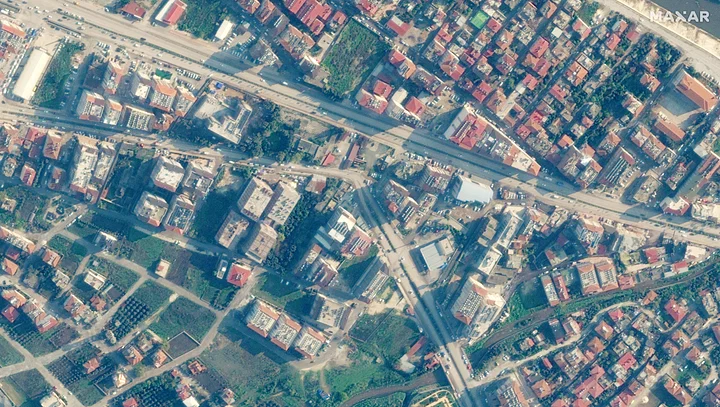
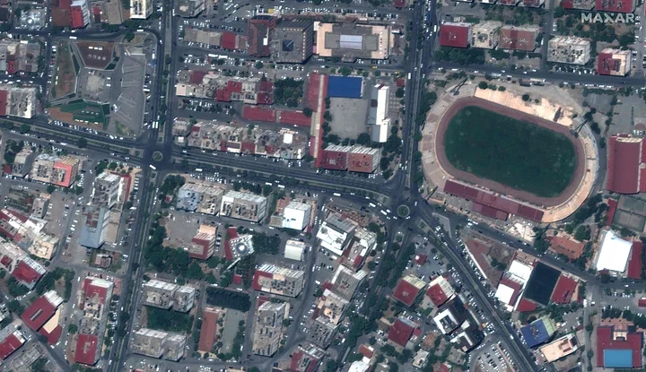
An area in the Kahramanmaras province of Turkey before the earthquake. 26 July 2022 Photo: AFP
6/ 6
After the earthquake, there is nothing left in the area. A shelter camp has been opened in the stadium. 8 February 2023 Photo: AFP